A celebration of backcountry trails in the Mountain State.
written by Nikki Bowman Mills, Pam Kasey, and Devin Lacy
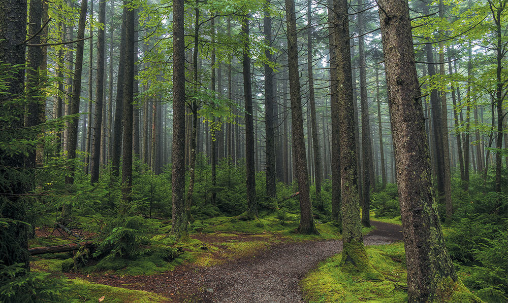
Anywhere you go in West Virginia, there’s a memorable hike close by. We can wander our most remote hills, woods, and waters for days without seeing a soul if we want to, a privilege in an ever more citified world.
What makes our access to all of this nature possible is a gift from those who came before us—thousands of miles of hiking paths, plus the trailheads, signage, shelters, and campgrounds that support our safe enjoyment of them. It’s an infrastructure that tames the wilderness just enough to make it approachable.
In the following stories, we bring you some of our state’s most iconic backcountry trails and some of our hidden footpaths, so lace up your boots, embrace your inner adventurer and explore the wonders that make West Virginia wonderful.
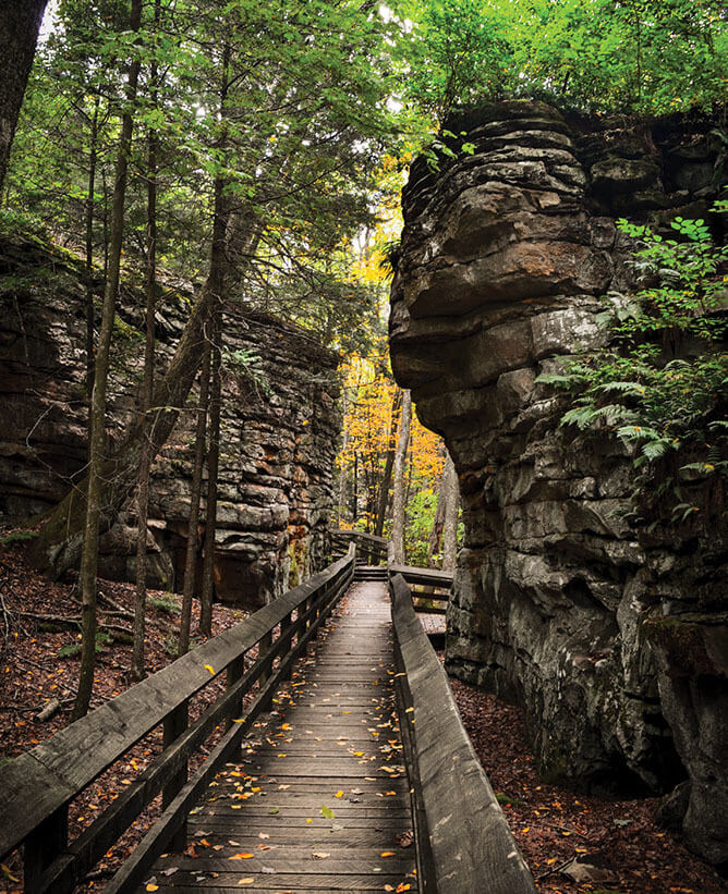
ROCK CITY TRAIL Coopers Rock State Forest
Not far from the main parking lot sits Rock City, a pathway of impressive rock formations just waiting to be explored. A quick mile out and one more back, this trail also connects to a selection of others if you’re itching for something a little longer.
BEARTOWN BOARDWALK Beartown State Park
This half-mile boardwalk needs to be on your to-explore list. It’s an easy walk—with multiple sets of stairs—that winds you through rock formations and crevices unlike anything you’ve seen.
NORTH BEND RAIL TRAIL Parkersburg to Clarksburg
One of the most popular rail trails in the state, the 72-mile North Bend Rail Trail can be accessed in many locations between its endpoints in Parkersburg and Clarksburg. Simply find the access point closest to you and wander to your heart’s content.
SUNRISE CARRIAGE TRAIL Charleston
Tucked away in downtown Charleston is something you wouldn’t expect: a quiet 1.4-mile round-trip trail with interesting monuments, vibrant foliage, and unique views of the capital city.
WILDERNESS TRAIL Holly River State Park
For those looking to spend the day on a trail, head over to Holly River. This trail requires some backtracking, so be sure to carry a reliable map and pay close attention to trail markers. Take in the nature around you as you go—you just might pass some old- and secondary old-growth along the way.
MILL MOUNTAIN–BIG SCHLOSS TRAIL George Washington National Forest
The trailhead for this excursion can be accessed from the Wolf Gap Recreation Area. While the first mile or so will give you a nice workout, you’ll quickly become so enamored with the views that it will be worth it.
SENECA ROCKS Monongahela National Forest
No matter which parking lot you choose to start from, the end result is the same: the awe and majesty of Seneca Rocks. While steep in parts, the trail is reported to be well-maintained with easy terrain.
ENDLESS WALL TRAIL New River Gorge National Park & Preserve
From the Nuttall parking lot trailhead to that of Fern Creek down the road—though the real adventure lies deep into the wilderness—the Endless Wall trail is 2.4 miles of scenic views and overlooks that you won’t want to miss.
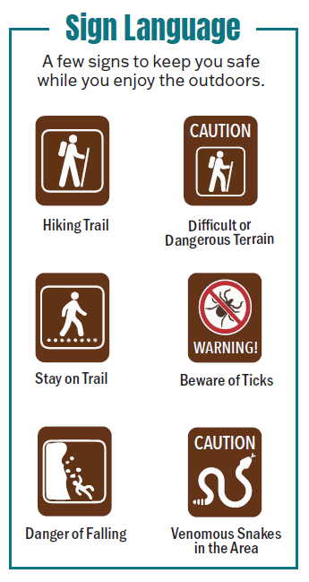
Any type of hiking you do—from a short jaunt to a multi-day excursion—requires preparation. Do your research, plan ahead, and prepare accordingly. Factors such as time of year, weather, available resources, and experience should be taken into consideration. Allow for adjustments to and flexibility with proposed distances and times based on skill, capabilities, and the potential for unforeseen conditions.
APPALACHIAN NATIONAL SCENIC TRAIL Monroe County
For those in the southern region of the state looking to conquer a section of the AT, 20 miles of it weave in and out along the Monroe County–Virginia border. While higher in elevation than its Harpers Ferry counterpart, it’s sure to be just as rewarding.
BLUESTONE TURNPIKE TRAIL Bluestone National Scenic River
This 9.5-mile hike connects two of West Virginia’s state parks: Bluestone and Pipestem. Pick your starting point, with plans to stay the night at the other end. There is roughly a mile of Pipestem’s River Trail between Mountain Creek Lodge and the park’s end of the Turnpike trail, so plan accordingly!
KANAWHA TRACE Ona
One of the more difficult—and longer—trails on this list, Kanawha Trace is roughly 30 miles of backpacking opportunity, from Fraziers Bottom to Barboursville. A variety of adventurers share the trail, so be on the lookout for mountain bikers, runners, and other campers.
Be Enchanted
West Virginia’s mountains are ancient, and its old-growth forests are living reminders of that. A few can be found at these locations:
- Cathedral State Park
- Monongahela National Forest
- Watoga State Park
- Carnifex Ferry Battlefield State Park
- Beech Fork State Park
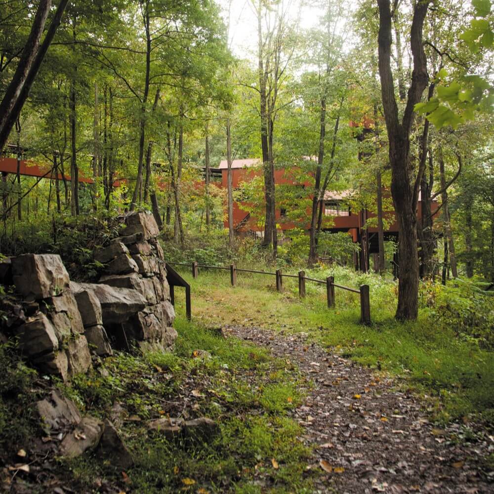
VIRGINIUS ISLAND AND HALL’S ISLAND TRAIL Harpers Ferry National Historical Park
This flat, easy 2-mile loop trail takes hikers past ruins and historical markers perfect for anyone looking to soak up a little extra history—and sunshine—while in Harpers Ferry.
TIPPLE AND TOWN LOOP TRAILS New River Gorge National Park & Preserve
See what is left of a previous coal town, Nuttallburg, preserved by time. Historical artifacts such as building foundations, a conveyor, and other remnants can be spotted, with signs that share some history.
BLENNERHASSETT ISLAND HISTORICAL STATE PARK Parkersburg
Take the ferry over to Blennerhassett Island to explore the multi-use loop trail located at the eastern end of the island. Stroll past the stunning Blennerhassett Mansion and enjoy its surprising history.
DROOP MOUNTAIN BATTLEFIELD STATE PARK Hillsboro
Head to this historic state park, site of the last major Civil War conflict in West Virginia. A number of short trails of varying difficulty lead to historic sites. The museum and lookout tower are a bonus.

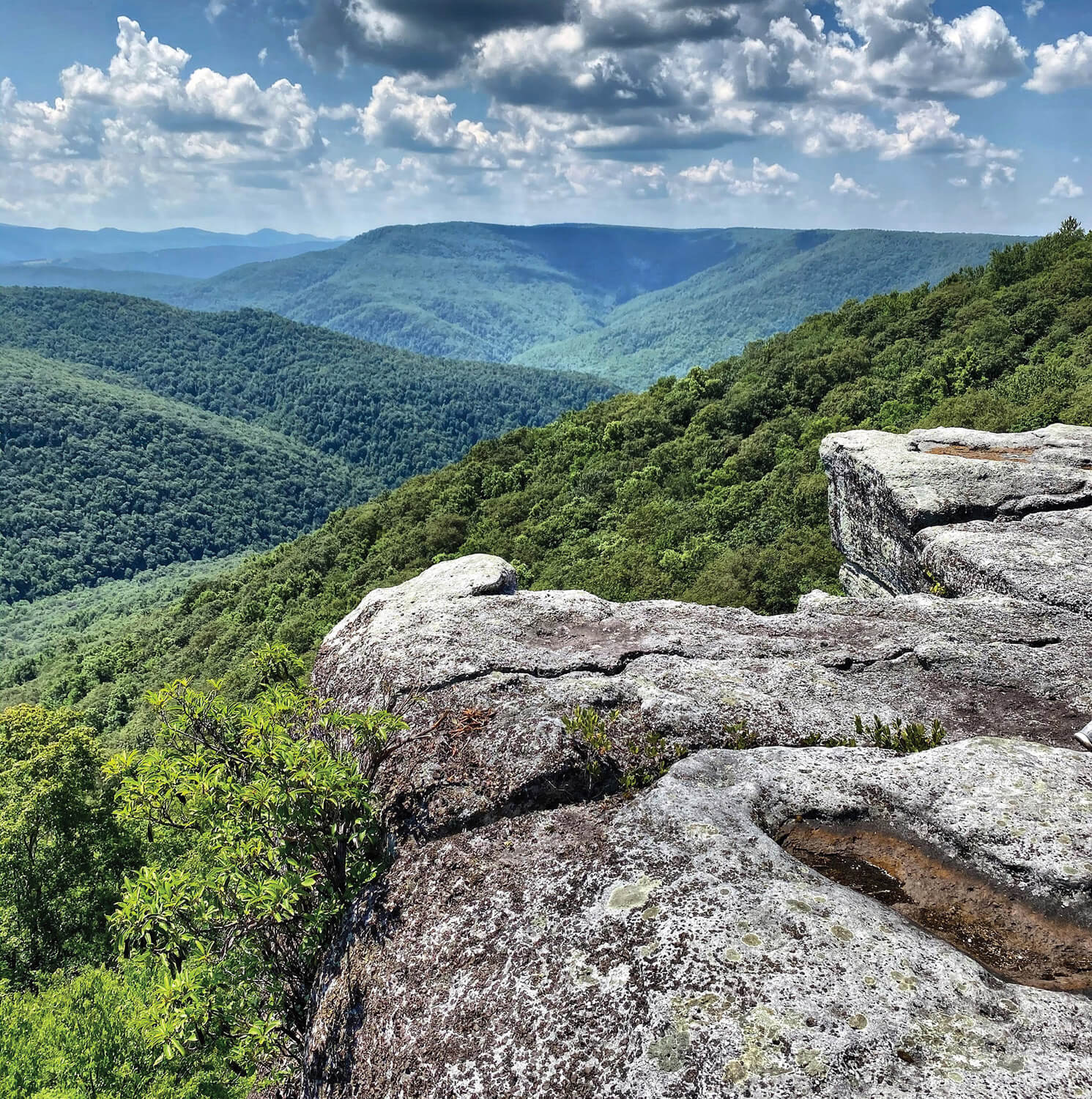
WHITE OAK TRAIL Lost River State Park
This 3-mile out-and-back trail at Lost River is anything but lost. You’ll be hiking towards Cranny Crow Overlook, a stunning view of five different counties with an Almost Heaven Swing nearby. This trail is shared by horses and their riders.
TABLE ROCK OVERLOOK TRAIL Monongahela National Forest
Off Canaan Loop Road is a roughly 2.5-mile out-and-back trail to Table Rock, offering unparalleled views as reward for a quick and easy hike. Be prepared for mud on the trail as you get closer to the rock. Once there, look out over the valley and take in the splendor.
FALLING ROCK TRAIL TO OVERLOOK TRAIL Pinnacle Rock State Park
This short and sweet hike takes you from the parking lot under Pinnacle Rock on Falling Rock Trail and around to Overlook Trail. Take the stone steps up to the overlook deck for a gorgeous view.
LONG POINT TRAIL Summersville Lake
Another easy trail with a view unmatched. This 4-mile out-and-back trail opens up to a rocky outcropping that serves as an overlook with views of the lake.
SPOTTED SALAMANDER TRAIL Kanawha State Forest
This out-and-back trail at Kanawha State Forest offers 0.5 miles of paved, wheelchair-accessible pathway bordered with rope guides and interpretive signs that include braille.
GENTLE TRAIL Blackwater Falls State Park
This hike might be short, but is no less beautiful. 0.2 miles out and back, this paved pathway leads right to one of Blackwater Falls’ overlooks for a lovely view of the roaring waterfall. The trail offers a chance to see the falls without the use of stairs.
CRANBERRY BOG BOARDWALK Cranberry Glades Botanical Area
See the bog and all its vibrancy up close on this boardwalk trail that takes you through a West Virginia marvel. It is deemed wheelchair accessible—just call the Gauley Ranger District at 304.846.2695 beforehand to check conditions for any obstacles or obstructions.
EXTRA MILE TRAIL North Bend State Park
The Extra Mile Trail at North Bend is another easily accessible trail outfitted with interpretive signs that include braille. It’s 0.6 miles of paved pathway out and back with a lookout deck at the end to pause and enjoy nature.
THE APPALACHIAN NATIONAL SCENIC TRAIL

The Appalachian Trail (AT) is made up of over 2,190 miles of public trail, spanning 14 states along the eastern U.S. and drawing more than 3 million hikers each year. Completed in 1937, the AT has served as a point of intrigue and adventure for travelers all over the country. As grand as it is, only 2.4 miles of the trail cross West Virginia at Harpers Ferry—the least out of all the states it runs through. Yet, the Appalachian Trail Conservancy’s headquarters can be found there, making it one of the best- known sections of the trail. The Conservancy, set up 12 years prior to the completion of the trail itself, is the organization working to “protect, maintain, and celebrate” all that the AT has to offer. Learn more at appalachiantrail.org.
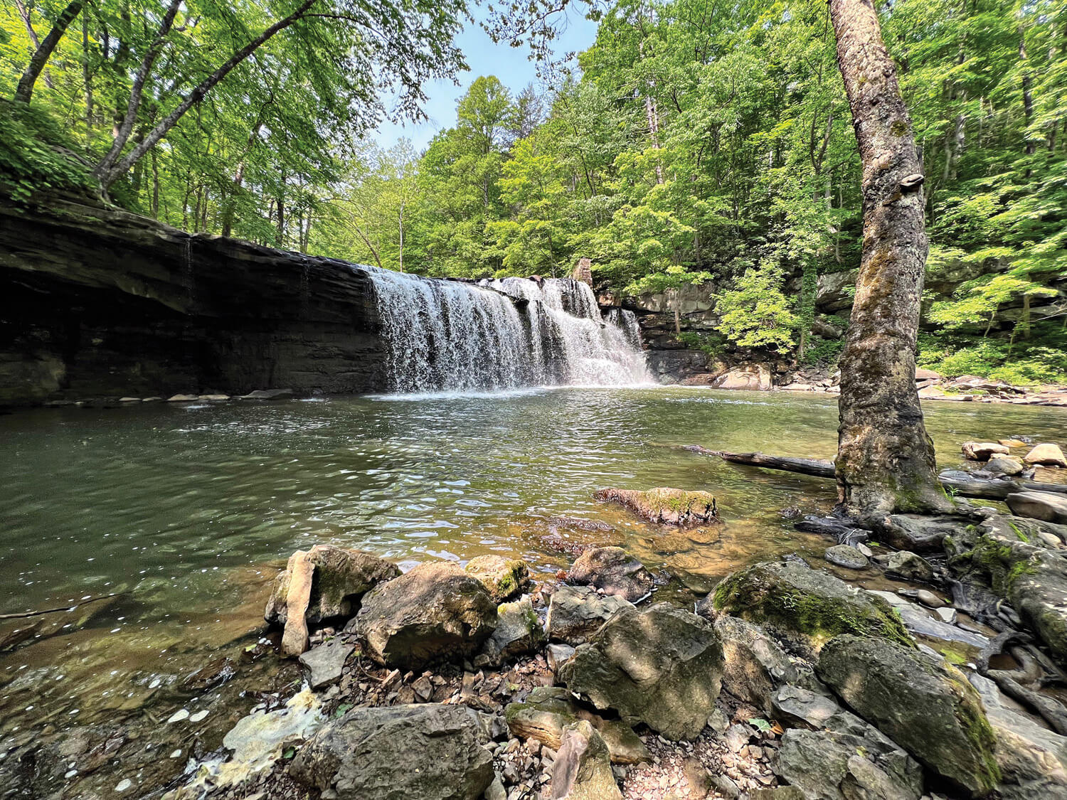
Brush Creek Preserve and Falls (pictured above)
This easy trail in Athens parallels Brush Creek and the Bluestone River in The Nature Conservancy’s Brush Creek Preserve. The 33-foot waterfall, located a half-mile from the entrance, is a beautiful spot to cast a line for trout and smallmouth bass.
Otter Creek Wilderness
Located near Harman, 45 miles of trails wind through the Monongahela National Forest. It can be challenging and muddy in spots, but Otter Creek is a favorite for anglers interested in native native brook trout.
North Bend State Park
North Bend State Park has 14 hiking trails and multiple fishing spots that include a recreational lake and river.
Sleepy Creek Wildlife Management Area
Sleepy Creek Wildlife Management area is home to several hiking trails as well as a 205-acre lake where you’ll find largemouth bass, bluegill, crappie, and northern pike.
Greenbrier River Trail
The Greenbrier River Trail follows a former railroad corridor for 78 miles through multiple small towns. The trail hugs the river for most of its length, and smallmouth bass are plentiful.
Red Creek Trail
Many miles of the 6.4-mile Red Creek Trail run along Red Creek, a great location for catching a variety of trout species, including native brook trout. Be sure to have a reliable map or navigation device with you!
Charles Fork Lake Loop
Surrounding Charles Fork Lake is a series of trails with ample opportunities for fishing walleye and bass from the lake’s waters. Located just outside of Spencer, the lake and its trails are accessible from its northern and southern points.
The Mountaineers’ 10 Essentials
This checklist, developed, tested, and refined over decades by the nonprofit group The Mountaineers, is a foundation that can be tailored to the nature of each outing.
- Navigation map, altimeter, compass, GPS device and extra batteries or battery pack
- Headlamp plus extra batteries
- Sun protection sunglasses, sun- protective clothes, sunscreen
- First aid including foot care and insect repellent, if called for
- Knife plus a repair kit
- Fire matches, lighter and tinder, or stove as appropriate
- Shelter can be a lightweight emergency bivvy
- Extra food beyond minimum expectation
- Extra water beyond minimum expectation, or the means to purify
- Extra clothes sufficient to survive an emergency overnight
READ MORE ARTICLES FROM SPRING 2024



Leave a Reply